Explore Whorneyside Force in Langdale, a stunning waterfall in the Lake District. Discover its beauty, hike the trail, and enjoy the striking landscape.
Walk Details
- Distance: 6.2 km (out and back)
- Elevation Gain: 285 metres
- Difficulty: Moderate
This walk offers a rewarding challenge with beautiful scenery along the way. Moderate fitness is required.
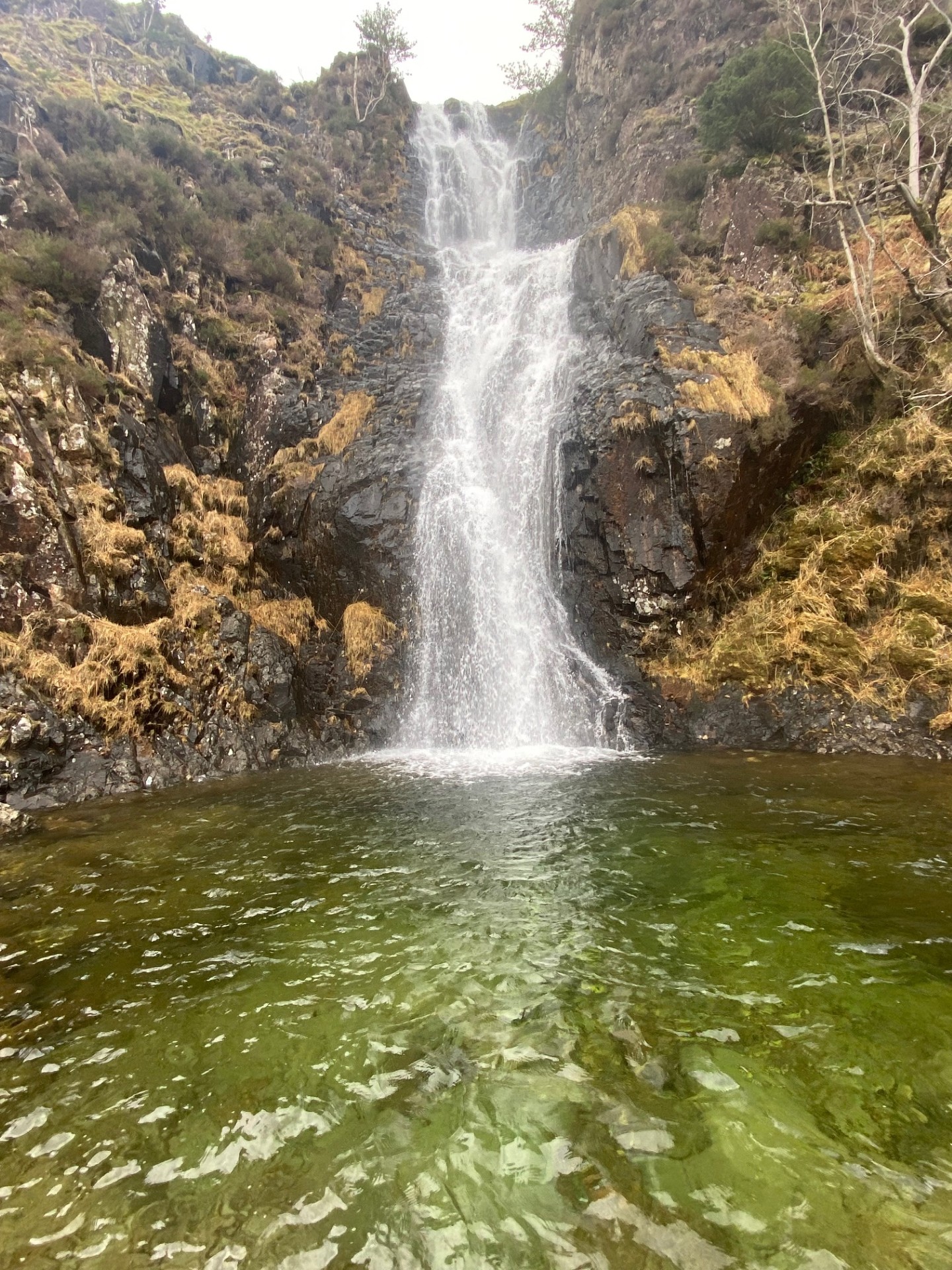
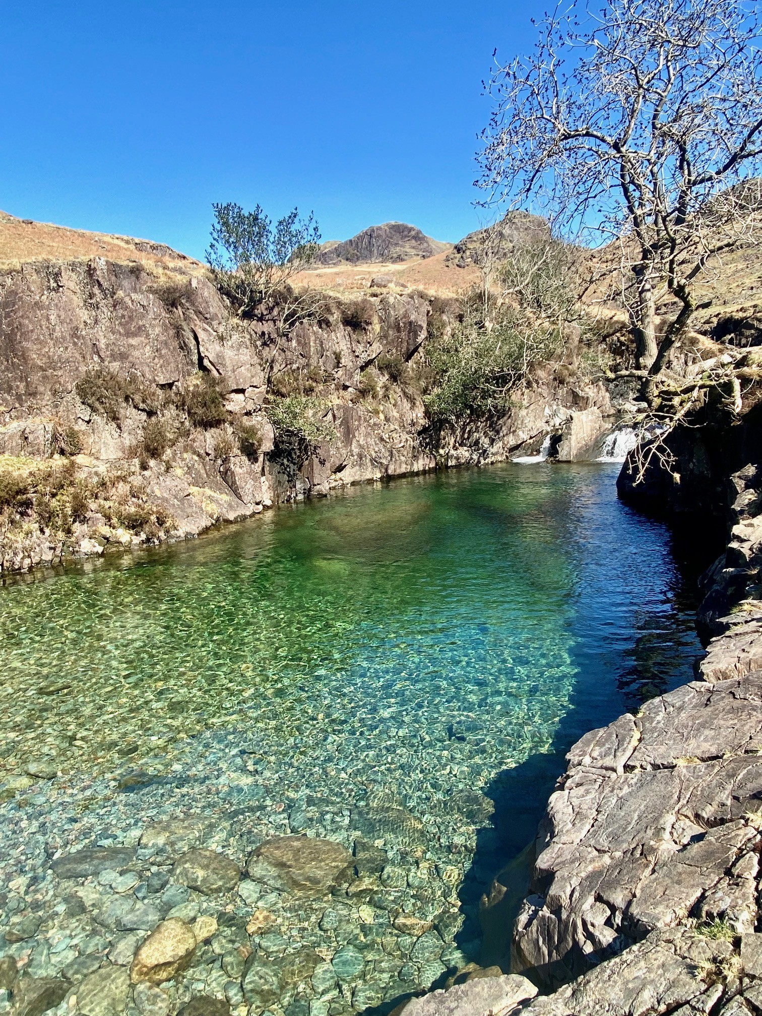
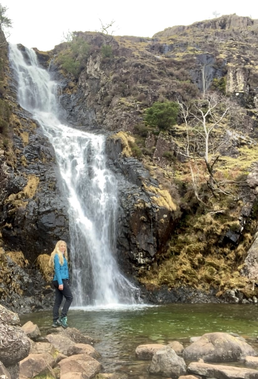
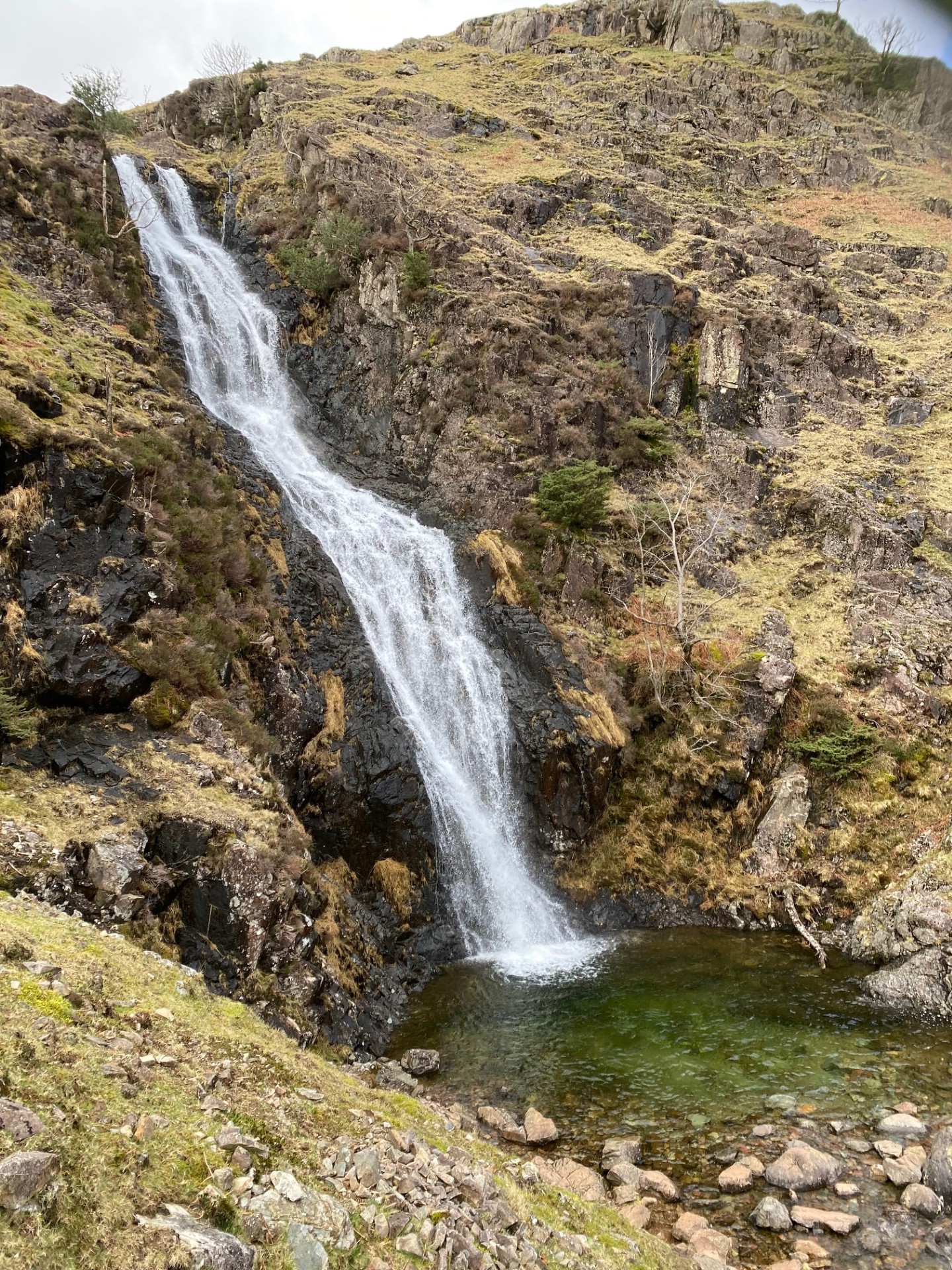
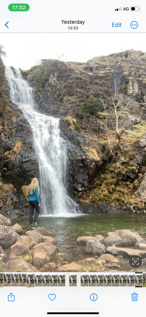
Whorneyside Force is an impressive 70 metre high waterfall on Oxendale Beck in the iconic Langdale Valley. Its enticing emerald green pool attracts wild swimmers during the warmer months of the year. For wild swimming safety information, click here.
How to Get to Whorneyside Force: Directions and Access in Langdale
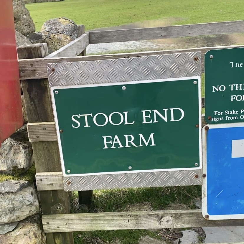
Starting in Great Langdale at the Old Dungeon Ghyll car park, turn right and follow the road until you see a green sign for Stool End Farm. Head through the wooden gate and follow the flat, scenic path as it winds through the valley.
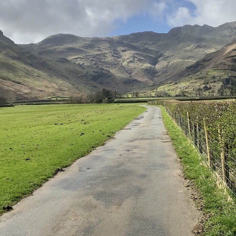
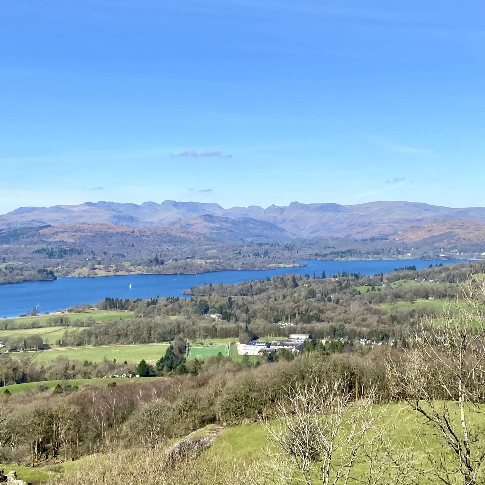
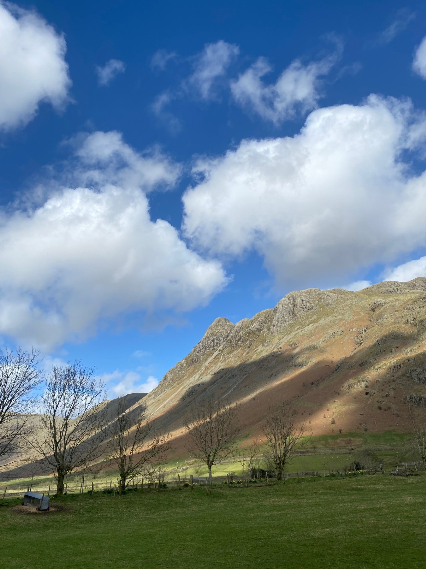
Here you’ll have fantastic views of the surrounding fells and the famous Langdale Pikes, including Pike o’ Stickle which is a prominent sight here.
Follow the path as it turns right toward Stool End Farm. Look out for a slate sign with an arrow pointing right, marked ‘The Band.’
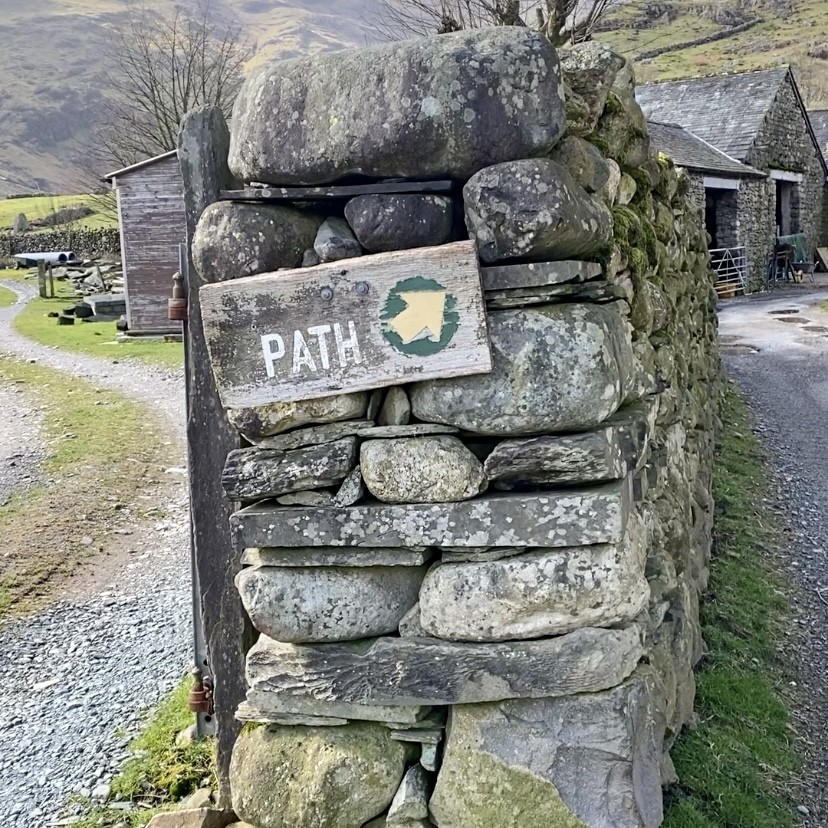
The footpath through the farm is well signposted. Take care whilst walking-tractors and other vehicles may be in use.
You’ll likely see cows in the barns and free roaming hens nearby. Keep voices low and dogs on a lead. Although this is a public footpath, it’s important to be respectful while passing through the farm.
After passing through the gate, you’ll see two paths. The paved one veers uphill, this is ‘The Band,’ a direct route to Bowfell, but it doesn’t pass Whorneyside Force.
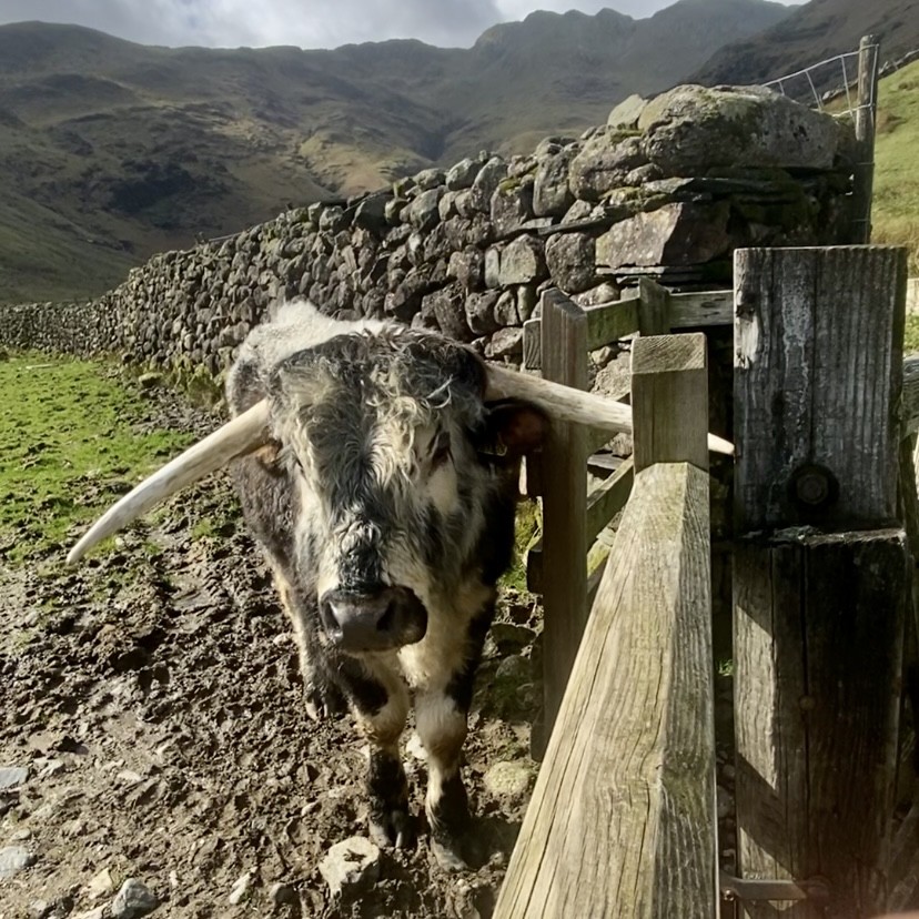
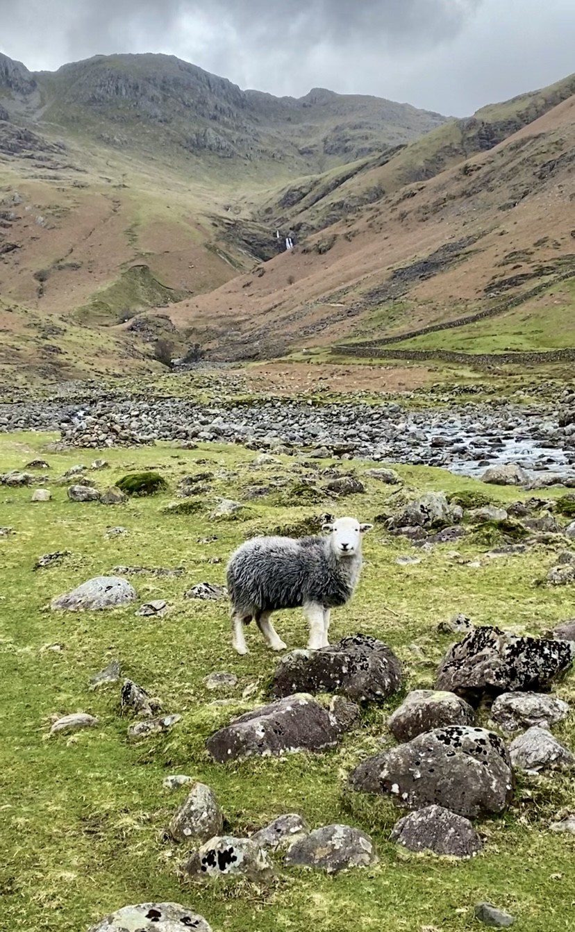
Instead, turn left through a wooden gate toward Oxendale Beck, visible just ahead. This field is home to Highland cows. Whilst they’ve always seemed docile in my experience, they do have large horns, so it’s best to keep a safe, respectful distance and dogs on leads.
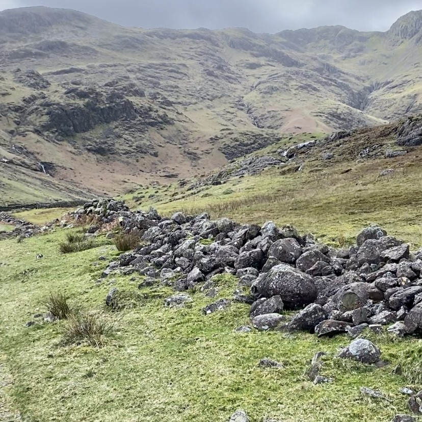
Follow the path alongside the beck, where you’ll notice old stone walls on either side, now crumbled and in ruins. The farmer told me the beck once flooded, causing the damage. The walls still stand, though they’ve never been rebuilt.
Fun Fact:
Vikings originally implemented the flow and direction of the beck, and local farmers have maintained this practice ever since.
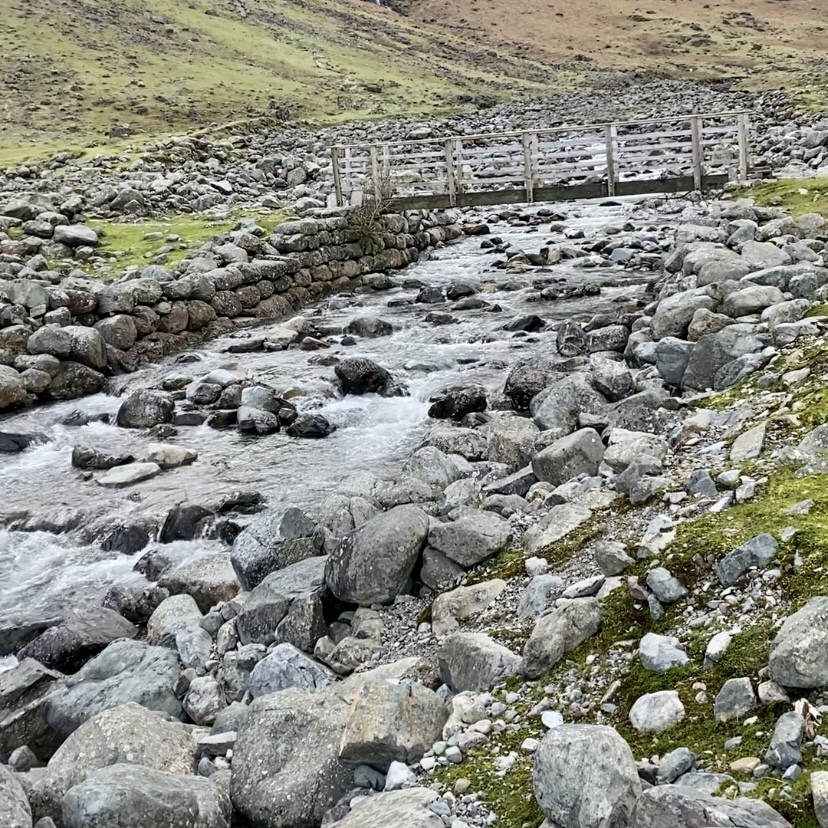
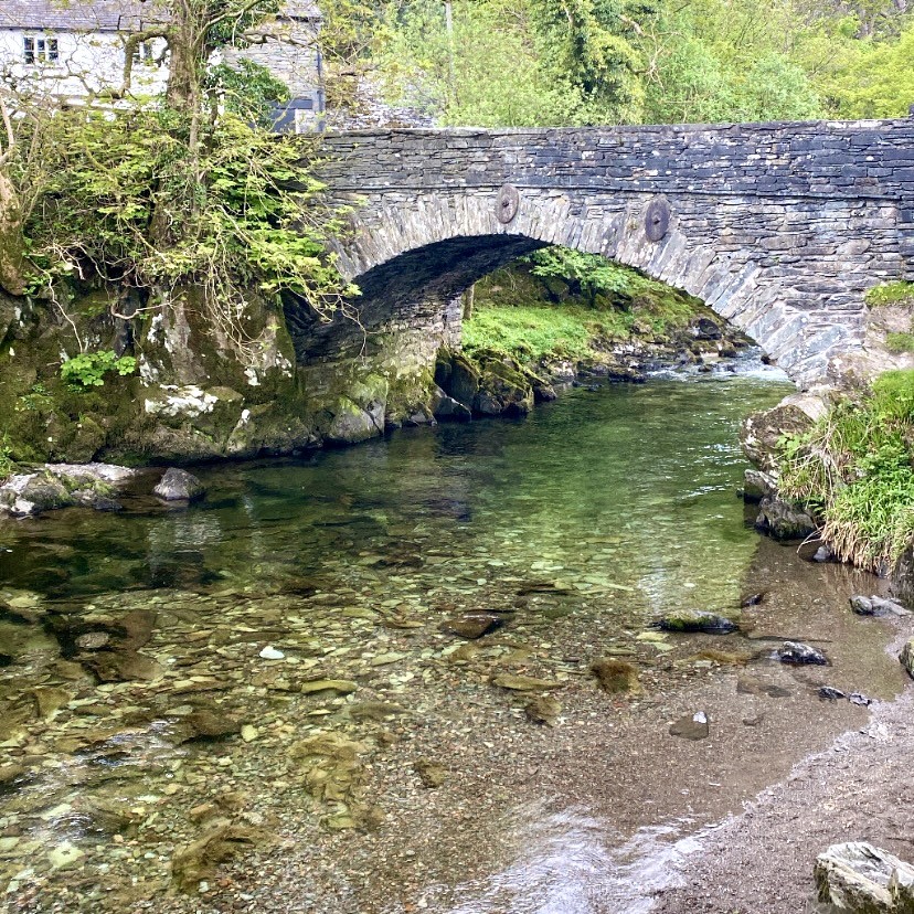
Keep following the path and you’ll come to a wooden bridge- perfect for viewing the river. There’s no need to cross it unless you’re heading up Pike O’ Blisco on the other side of the beck.
Continue walking along the right hand side of the beck. Soon, you’ll spot a beautiful waterfall on the left of the river, and the path begins to climb gradually uphill.
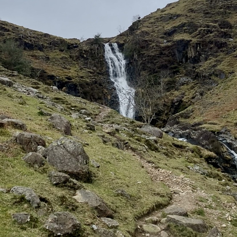
Whorneyside Waterfall
As you approach Whorneyside Force, you’ll catch a glimpse of its top poking out, partially hidden by a hill.
There are two paths to the waterfall: the main path climbs higher, giving you a view of the falls from above on your right. Alternatively, a smaller path leads directly to the base of the falls, I highly recommend taking this for an unforgettable close-up experience.
To return to Old Dungeon Ghyll car park, simply retrace your steps along the same path. If you’re feeling adventurous, you can continue past the waterfall and follow the path all the way up to Bowfell, which stands at 900 metres.
The route to Bowfell from Whorneyside Force passes beautiful waterfalls in the ravines of Buscoe Sike and Hell Gill. Be sure to stay on the path, as there are steep drops along the way and often, strong winds.
How Long Is the Walk to Whorneyside Force Waterfall?
The walk to Whorneyside Force and back from Old Dungeon Ghyll takes around two hours, depending on your level of physical fitness and walking pace.
Essential Equipment: What to Bring for the Waterfall Hike
- OS map or OS Maps app – Useful for navigation, especially if mobile signal is weak.
- AllTrails app – Great for tracking your route and finding nearby points of interest.
- Good footwear (hiking boots or trainers) – Essential for comfort and grip on uneven or slippery terrain.
- Water – Stay hydrated throughout the hike, especially on warmer days.
- Food/snacks – Bring energy boosting snacks for the walk.
- Charged phone – For safety, navigation and capturing photos.
- Power bank – Keeps your phone and devices charged during longer hikes.
- Swimwear and towel – Perfect if you want to take a dip in the waterfall’s pool during warmer months.
- Camera – Capture the stunning scenery and special moments along the trail.
Parking for Whorneyside Force at Old Dungeon Ghyll: Location and Coordinates
- What3Words: ///gears.fractions.object
- Grid Reference: NY 28579 06114
- 6-Figure Grid Reference: NY285061
- Postcode: LA22 9JY
Whorneyside Waterfall, Great Langdale, Lake District: Location and Coordinates
- What3Words: ///clues.derailed.causes
- Grid Reference: NY 26134 05361
- 6-Figure Grid Reference: NY261053
- Nearest Postcode: LA22 9JY
Loved this? You may also like: Esk Falls and Tongue Pot: Waterfalls in the Lake District